As noted on the maps on pages 34 and 36, there are four different areas of the county developing horse trails and five developing ATV trails in Knott County. Only the ATV and horse trails in the northwest quadrant of the county have been GPS mapped, landowners identified and signage added.
GOAL #1: GPS map all existing trails in the county and identify ownership.
An ARC grant has been received by the Knott County Fiscal Court to map the trails, identify ownership and obtain permission from the property owners to open the trails for public use.
ACTION TAKEN:
NEW ATV TRAIL DEVELOPMENT Thus far, four ATV trails located in the southeast, east and northeast quadrants of the county have been mapped and property owners are now being identified.* These include the Red Fox ATV Trail in the southeast quadrant of the county (which goes into both Letcher and Perry Counties), the Fire Trail in the eastern quadrant (which is being expanded into the Big Branch area of Letcher County) and the Brushee Fork Trail in the northeast quadrant. All of the ATV Trails lead into other counties. Agreements will need to be made with these counties to allow this and possibly establish additional trailheads to the trails that enter from their counties.
PROPOSED ATV TRAILS IN KNOTT COUNTY RECENTLY MAPPED
PROPOSED HORSEBACK RIDING TRAILS RECENTLY MAPPED
*Please Note: Detailed maps and information on all of the above trails are available upon request and will be included in a final report on trail development in Knott County which will be available in January 2009.
ATV TRAIL DEVELOPMENT: Trails in the sections of the county highlighted in blue are now being mapped and property owners identified to determine willingness to open the trails for public use. Best site locations for trailheads, camping, and basic infrastructure such as water and restroom facilities are also being considered.
EXISTING HORSE TRAILS:
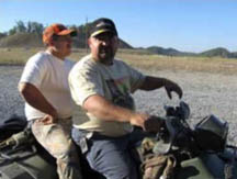
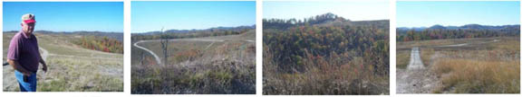
There are three horse trails in Knott County that have been developed, GPS mapped, and signage added. They are located on Western Pocahontas property in the northwest quadrant of the county using the Sutton Memorial Park near the Knott County ATV Training Center as the trailhead. These trails are currently being used for both the Spring and Fall Knott County-sponsored Trail Rides held annually.
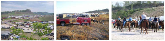
This year’s Fall Trail Ride attracted over 4,000 riders and 2,500 horses.
A few photos from annual Knott COunty Trail Ride that attracts thousands of riders to
southeast Kentucky.
NEW HORSE TRAILS AND PROPOSED HORSE CAMPS:
An additional horse trail has also been added to the three existing trails developed on Western Pocahontas property in the northwest quadrant of the county near Sutton Memorial Park. The goal is to develop additional trails in this area which will eventually connect to trails being developed in South Fork area of Breathitt County.
There have also been two horse trails mapped in the south central and southwest quadrants of the county.
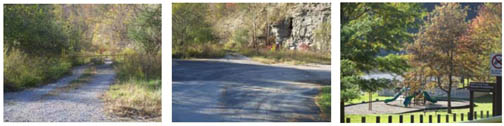
One proposed six mile trail called the Shingle Branch Trail is located near Carr Creek Lake primarily on Corps property. The trailhead is at the entrance to U.S. Army Corps of Engineer’s Littcarr Recreational Area. Easy access, ample parking plus overflow parking and restroom facilities within 200 yards of the trailhead make this site ideal.
The other trail encompasses Martin Branch, Dismal Branch, Pine Tree Hollow and Thornsberry near Mousie and may eventually beextended to include Bear Branch and the Triplett area into Floyd County.
Carl Gibson, one of the property owners, is providing assistance in mapping the trails and identifying other landowners on this reclaimed coal site.
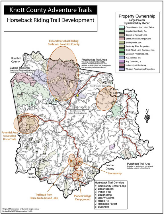
HORSE TRAILS: The map below highlights locations in Knott County where horse trails, trailheads and/or horse camps are proposed. Trails are currently being developed and property owners identified to determine willingness to open their land to the public.
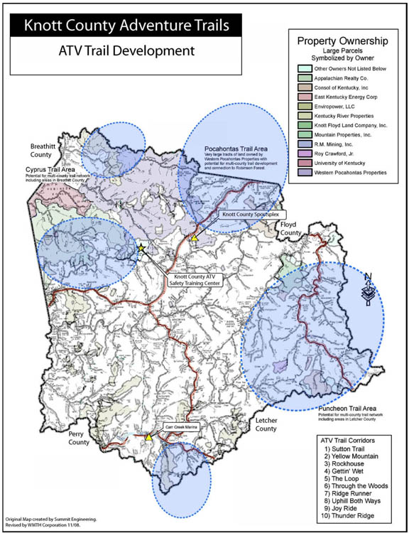
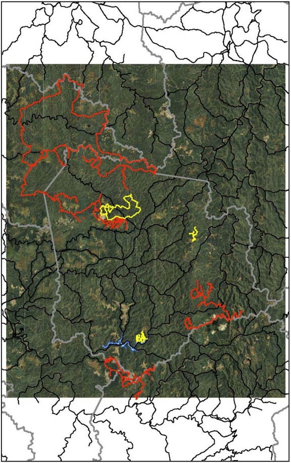
KNOTT COUNTY OVERALL TRAIL MAP:
Below is a map of Knottt County which displays the location of each of the trails being developed within the county. Horseback riding trails are featured in yellow and ATV trails are in red.
Trails* noted on the map include:
Red Fox ATV Trail #4 in S.E. quadrant leads into Perry & Letcher Counties.
Fire ATV Trail #2 in East quadrant leads into Letcher County.
Sutton’s Elk View ATV Trail #1 in northwest quadrant leads into Breathitt County.
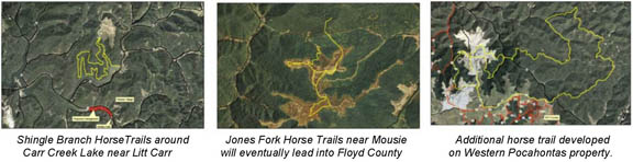
Shingle Branch Horse Trails around Carr Creek Lake near Litt Carr.
Jones Fork Horse Trails near Mousie will eventually lead into Floyd County.
Additional horse trails developed on Western Pocahontas property in the northwest quadrant of the county. *Details on trails available upon request.