Kentucky has more miles of running water than any state except Alaska.
The western portion of the state offers numerous paddling opportunities, including one Wild River--26 miles of the Green River within the confines of Mammoth Cave National Park. This classic flat water run allows camping on islands or riverside sites and features abundant wildlife and rivers bubbling up from underground caverns.
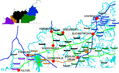
In this section you will find maps and information on access points, water temperature and velocity, suitability, portages, gradient, level of difficulty, and more.
Just click on one of the color-coded icons or regions on the maps or refer to the list below to begin your West Kentucky canoeing adventure!
Our thanks to Bob Sehlinger, author of "A Canoeing & Kayaking Guide to Kentucky."Mr. Sehlinger allowed the use of the information from his guide to be utilized on this website. Click here for more on Mr. Sehlinger.
WMTH CORPORATION PO BOX 51153 BOWLING GREEN, KY 42102 PHONE (270) 792-5300 FAX 721-0004