The Breathitt County Fiscal Court proposes to develop river trails on both the North Fork & the Middle Fork
of the Kentucky River.
NORTH FORK OF THE KENTUCKY RIVER
The vision of the North Fork Project is a 54-mile long canoe route that will begin at Douthitt Park in Jackson and follow the North Fork to St. Helens. According to the Outdoor Industry Foundation, canoeing and kayaking are among the fastest growing types of recreation in the U.S. and several enthusiasts currently navigate this route. The project proposes to improve and enhance North Fork’s value as a recreational, historical, cultural and educational experience by making the river more accessible, safer and easier to use.
MIDDLE FORK OF THE KENTUCKY RIVER
The Middle Fork Project will be a 38 mile long canoe route that will begin at Lee County line ending at the Perry County line.
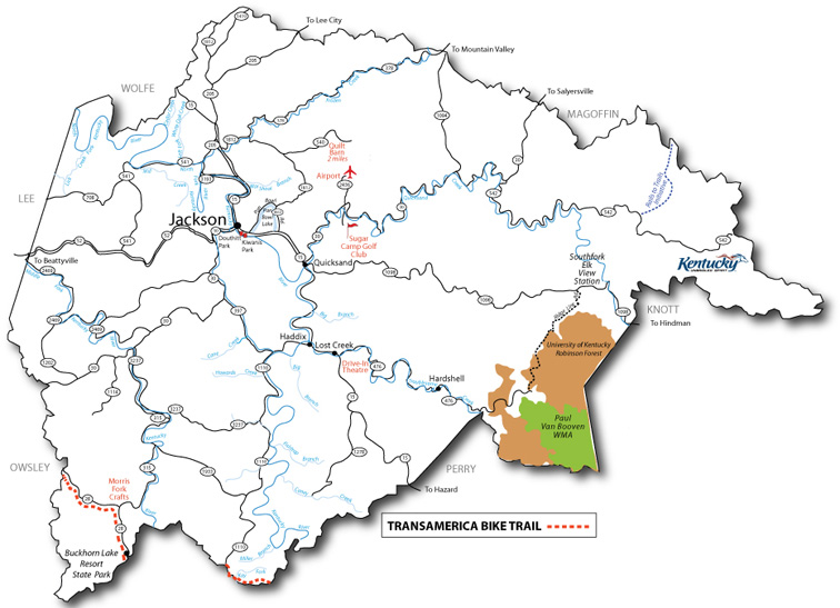
Two other worthwhile rivers to explore in Breathitt County are the Quicksand River and the Troublesome Creek River. Both of these rivers provide excellent fishing opportunities, but are only navigable in very early spring when water table is high. Access points are noted in red.
QUICKSAND CREEK
Quicksand Creek runs east to west throughout Breathitt County beginning in Knott County. It is a beautiful low-water creek that requires some wading when using a canoe. The drops (gradient) usually occur as small, narrow shoals and there are many pools that provide good fishing. The creek narrows higher in the watershed and is choked with willows in areas below Rosseau school. Elevation drop throughout this creek is significant but the water volume and stream width tend to preclude whitewater in normal conditions. However, when it rains, this stream as all streams in the Mountains can become a roaring and dangerous whitewater river. County Road 30 runs along side the creek where it can be paddled. Its confluence with the N. Fork of the Kentucky River is near the University of Kentucky Ag Extension station and is about three miles above Jackson, the Breathitt County Seat.
Access points:
1. Quicksand Volunteer Fire Dept. Access below County Rd. 1812 Bridge
(Confluence with N. Fork of KY River) 37° 32’ 05.5”, 83° 20’ 55.8”
2. Noctor Access pull-off (private) (River Rt.) by Church with Red roof.
37° 33’ 34.5”, 83° 20’ 12.5”
This creek is a beautiful low-water creek that has good fishing and is well-shaded. It requires some wading when using a canoe. The drops (gradient) usually occur as small, narrow shoals. Elevation drop throughout this creek is significant but the water volume and stream width tend to preclude whitewater in normal conditions. However, when it rains, this stream as all streams in the Mountains can become a roaring and dangerous whitewater river. County Road 476 runs along the creek where it can be paddled. It begins in Perry County and runs to the confluence with the N. Fork of the Kentucky River.
Access points:
1. Riverside Christian School (Church) Access (River Lt.)- (Approx. one mile
from confluence with the N. Fork of Kentucky River). The access is river
right, above the bridge. Access is through the school/church grounds.
Parking should be on the street. 37° 28’ 43.4”, 83° 19’ 33.4”
2. Roadside Access (River Rt.) 2 miles above Riverside Christian School
(Church) and below Noctor, River rt. (No GPS Reading)
Both the North Forks and Middle Forks of the Kentucky River are cited extensively in Sehlinger and Molloy’s Book: A Canoeing & Kayaking Guide to Kentucky, 5th edition. These are the two primary Blueways routes in Breathitt County and numerous access points are listed in the text. However, additional access points are available and should be added.
Two additional access points for the North Fork are:
1. Big Branch access at Kragan
2. Rock Lick Creek Access on Spencer Bend
There may be additional creeks that could be paddled in high water. However, when considering safety and the useof blueways for tourism, these four waterways and Pan Bowl Lake provide the primary opportunity for Blueways in Breathitt County.
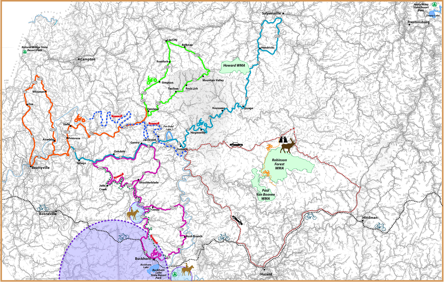
Trail Map Below(click on for larger version)
Scenic Byway - travels through three counties and by two elk viewing stations. In Breathitt County it travels by the South Fork Elk View Station near Robinson Forest. *see below
Buckhorn/Middle Fork River Trail #1 - Blueway. Canoeing
North Fork River Trail #2 -Blueway. Canoeing
WMTH Corporation, PO Box 51153, Bowling Green, KY 42102 (270) 792-5300